
Garmin eTrex SE
4.2Editor score
Long battery life
Multi-GNSS support
Water-resistant design
Navigating the open water requires reliable tools to ensure safety and efficiency. A quality GPS for Sailing provides essential data like position tracking and route planning which are critical for every sailor. Whether you are racing or cruising, having the right device can make all the difference.
We have reviewed a wide range of marine navigation devices to find the top options available today. Our comparison focuses on accuracy durability and specific sailing features that matter most to boaters. Each product was selected based on its ability to handle the unique demands of the marine environment.
Every pick in this list highlights key strengths and potential trade-offs for different types of sailors. We include handheld units for portability and larger chartplotters for detailed onboard navigation. Please note that product availability and pricing can change so check current details before purchasing.
4.2Editor score

4.0Editor score

5.0Editor score
As an Amazon Associate we earn from qualifying purchases.
The following table provides a side-by-side overview of the top ten marine GPS devices reviewed in this guide. Compare key specifications and features to find the unit that best fits your sailing needs.





The Garmin GPSMAP 79sc stands out as a top choice for sailors needing a reliable handheld device. It holds a solid 4.0 star rating from users who appreciate its rugged build and essential marine features.
We may earn a commission when you buy through this link, at no additional cost to you.
This unit comes preloaded with BlueChart g3 coastal charts which provide detailed navigational data right out of the box. The device supports multiple satellite constellations ensuring accurate tracking even in challenging environments like dense tree lines or near tall structures.
While it offers excellent battery life up to twenty hours in GPS mode the memory capacity might be limited for those planning extremely long expeditions. However for typical coastal sailing trips these constraints are rarely an issue for the average user.
We recommend this device for sailors who want a balance of durability and advanced charting capabilities without investing in a full fixed system. Its floating design adds an extra layer of security in case it is accidentally dropped overboard.
The built-in tilt-compensated electronic compass provides accurate heading information even when the boat is stationary which is vital for precise maneuvers.
With up to twenty hours of battery life this unit can sustain long day trips or overnight voyages without needing frequent recharges.
We may earn a commission when you buy through this link, at no additional cost to you.
The Garmin GPSMAP 65s is designed for users who demand the highest level of location accuracy in difficult environments. With a high 4.6 star rating it is praised for its multi-band technology that optimizes signal reception.
We may earn a commission when you buy through this link, at no additional cost to you.
This handheld features expanded global navigation satellite systems support allowing it to connect to more satellites simultaneously than standard units. The result is faster and more reliable positioning which is critical when navigating narrow channels or complex coastlines.
One trade-off is that the device is somewhat heavier than other handhelds due to its advanced internal components. Additionally the price point is higher but the performance gains often justify the extra expense for serious navigators.
Sailors who frequently operate in areas with poor signal coverage or need precise tracking for logging routes will find this unit invaluable. Its robust feature set ensures you never lose your way even when conditions are less than ideal.
Multi-band technology allows the device to filter out signal interference from obstacles ensuring you get the best possible GPS lock.
Includes routable TopoActive mapping which helps visualize terrain and waterways for better trip planning and situational awareness.
We may earn a commission when you buy through this link, at no additional cost to you.
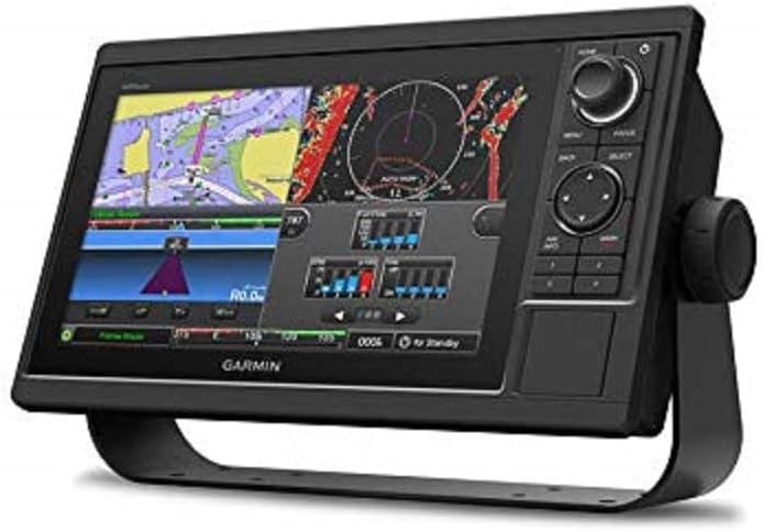
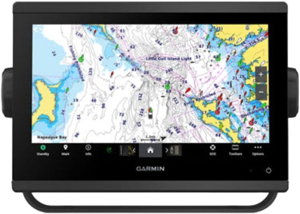
The Garmin GPSMAP 1022 offers a substantial viewing area ideal for fixed installations on larger boats. Its 4.5 star rating reflects user satisfaction with its clear display and expandable storage options.
We may earn a commission when you buy through this link, at no additional cost to you.
This unit accepts two SD cards allowing users to load multiple map regions or data types without worrying about running out of space. The dual Marine Network ports facilitate easy integration with other onboard systems like radar or instruments.
Because it is a fixed unit it requires permanent installation which might not suit smaller vessels or those wanting a portable solution. The larger display also consumes more power so it is best suited for boats with adequate electrical systems.
For sailors who need a central navigation hub on the helm this chartplotter delivers exceptional performance and clarity. The ability to expand storage ensures you have all the necessary charts for long-range cruising at your fingertips.
Dual SD card slots allow for seamless expansion of map data ensuring you can carry charts for multiple regions.
Multiple Marine Network ports enable connection to sensors and instruments creating a unified navigation system.
We may earn a commission when you buy through this link, at no additional cost to you.
The Garmin eTrex 22x is a rugged handheld designed to withstand harsh conditions while providing reliable navigation. With a 4.3 star rating it is valued for its durability and straightforward operation.
We may earn a commission when you buy through this link, at no additional cost to you.
This unit features a 2.2 inch color display that remains visible even in bright sunlight. It includes eight gigabytes of internal memory and a microSD card slot for additional map storage making it versatile for various trips.
The battery life is a standout feature offering up to twenty-five hours of use which is ideal for extended excursions. However the interface is basic compared to more premium models which might limit advanced route planning capabilities.
Ideal for sailors who also hike or camp this device offers a simple and reliable way to track your position. Its rugged design ensures it can handle the bumps and splashes of outdoor adventures without failing.
Powered by two AA batteries it offers up to twenty-five hours of GPS use ensuring long trips without recharges.
Built to withstand rough handling this navigator is perfect for users who need a dependable tool in varied environments.
We may earn a commission when you buy through this link, at no additional cost to you.
The Garmin GPS 73 is tailored for sailors with specialized features designed to assist with racing and routine navigation. It holds a 4.4 star rating for its user-friendly interface and dedicated sailing functions.
We may earn a commission when you buy through this link, at no additional cost to you.
Key features include SAILASSIST tools such as virtual starting lines and speed history which are essential for racers. The device also offers marine alarms including man overboard notifications to enhance safety on the water.
While it is an older model compared to newer chartplotters it remains a robust option for those who prioritize simplicity and core functions. The dedicated backlit buttons make operation easy even in low light conditions.
This unit is perfect for sailors who want a dedicated handheld without complex menus. Its focus on marine specifics ensures you have the right tools at hand for safe and efficient sailing.
Virtual starting lines and countdown timers help racers optimize their starts and improve on-water performance.
Marine alarms like man overboard alerts provide critical notifications to help keep everyone safe on the water.
We may earn a commission when you buy through this link, at no additional cost to you.
The Garmin GPSMAP 9210 represents the pinnacle of marine navigation technology with a perfect 5.0 star rating. It features a ten-inch Full HD display and advanced processing capabilities for superior performance.
We may earn a commission when you buy through this link, at no additional cost to you.
Sailors will appreciate the premium sailing features such as sailing polars and layline guidance which assist in optimizing boat speed and direction. The device supports Gigabit Ethernet speeds ensuring fast data transfer across the boat network.
The high price point reflects its premium build and advanced feature set which may be overkill for casual boaters. However for serious sailors who need detailed performance data and seamless integration it is unmatched.
We recommend this unit for large vessels where budget is less of a concern and high-end navigation is required. The visual clarity and speed of operation make it a joy to use under any sailing conditions.
Sailing polars and laylines help you visualize performance data and make real-time adjustments for better speed.
Gigabit Ethernet ensures fast communication between sensors and instruments keeping your data flowing instantly.
We may earn a commission when you buy through this link, at no additional cost to you.
The Garmin GPSMAP 79s is a waterproof handheld designed to float if dropped overboard making it ideal for active sailors. It has a 4.2 star rating for its reliability and essential marine navigation features.
We may earn a commission when you buy through this link, at no additional cost to you.
This unit comes with a worldwide basemap which is helpful for general navigation without needing specific regional charts. The IPX6 water resistant rating ensures it can handle splashes and rain without damage.
While it lacks detailed preloaded charts it provides accurate positioning and compass data for basic route tracking. The floating design adds a layer of safety that is particularly valuable in rough water conditions.
Sailors who want a backup device or a simple navigation tool will find this unit practical and secure. Its ability to stay afloat ensures you never lose a valuable electronic device overboard.
Designed to float this unit prevents loss overboard ensuring you always have a backup navigation tool.
Includes worldwide basemap data for general navigation anywhere in the world without needing extra purchases.
We may earn a commission when you buy through this link, at no additional cost to you.
The Garmin GPSMAP 943xsv is designed for anglers and sailors who need detailed underwater imaging alongside navigation. It holds a 4.7 star rating for its ultra-high definition sonar capabilities.
We may earn a commission when you buy through this link, at no additional cost to you.
This unit supports Panoptix sonar technology allowing for real-time views of what is happening above and below the water. The improved optics on the display ensure that sonar images are clear and easy to interpret.
While it excels in sonar performance the cost can increase significantly if you need compatible transducers. However the clarity provided is unmatched for spotting underwater structures or obstacles near your boat.
This device is perfect for those who enjoy sport fishing or navigating shallow waters where underwater visibility is crucial. It combines high-quality navigation with powerful imaging tools to enhance your experience on the water.
Panoptix support allows you to see underwater structures in real-time improving navigation and fishing success.
Improved display optics ensure that sonar data is crisp and easy to read even in bright sunlight.
We may earn a commission when you buy through this link, at no additional cost to you.
The Garmin eTrex 10 offers essential navigation features at an affordable price point. It has a 4.3 star rating for its reliability and long battery life which users find valuable.
We may earn a commission when you buy through this link, at no additional cost to you.
This unit features a monochrome display which is less vibrant but highly readable in sunlight. It is waterproof to IPX7 standards providing robust protection against rain and splashes.
While it lacks advanced mapping it is perfect for those who just need basic position tracking and waypoint management. The support for HotFix and GLONASS ensures you get a fast lock on satellites.
For budget-conscious sailors this device provides peace of mind without breaking the bank. Its simplicity means it is easy to learn and use for basic navigation tasks.
IPX7 waterproofing ensures this device can handle the elements without needing expensive extra covers.
HotFix support helps the device find satellites quickly so you spend less time waiting and more time navigating.
We may earn a commission when you buy through this link, at no additional cost to you.
The Garmin eTrex SE is built for extended trips with a battery life that can last up to one hundred sixty-eight hours. It holds a 4.2 star rating for its durability and long-lasting power.
We may earn a commission when you buy through this link, at no additional cost to you.
This handheld features a digital compass that provides accurate heading even when stationary which is useful for precise navigation. The Multi-GNSS support ensures reliable tracking in various environments.
While it does not support complex map downloads it is an excellent choice for those who prioritize battery longevity over advanced charting. It is rugged and water-resistant ensuring it works in tough conditions.
Sailors on long voyages will appreciate the ability to go weeks without changing batteries. This reliability makes it a strong backup option for critical navigation tasks.
With up to one hundred sixty-eight hours of battery life you can rely on this device for extended expeditions.
The digital compass works even when the boat is stationary giving you a reliable heading reference.
We may earn a commission when you buy through this link, at no additional cost to you.
Choosing the right GPS requires balancing portability screen size and specific features needed for your type of sailing.
Larger chartplotters offer detailed maps and better visibility but take up space on your boat. Handhelds provide portability and are easier to use while moving around the deck.
Choose a display size that fits your boat layout and ensures you can read data easily in all lighting conditions.
Marine environments are harsh so a high water resistance rating is essential. Look for devices rated at least IPX6 to handle splashes and rain.
Higher ratings like IPX7 ensure the device can survive accidental immersion in water temporarily.
Some units come preloaded with coastal charts while others require you to purchase SD cards separately. Check if the included maps cover the areas where you sail.
Preloaded maps save time and money while buying specific cards offers more customization for your routes.
If you sail for long periods without easy access to power look for devices with high battery capacity. Handhelds using AA batteries can last for days on a single charge.
Ensure you have spare batteries or a charging method that fits your sailing style.
Specialized devices offer features like sailing polars and race start line guidance. These tools help optimize performance and strategy.
If you race frequently these features are invaluable for analyzing and improving your on-water performance.
Modern chartplotters support network connections to share data with other instruments on board. This integration allows for better monitoring of engine performance or radar data.
Ensure the device supports standard protocols like NMEA to communicate with your existing marine electronics.
Marine devices must withstand UV exposure vibration and potential impacts. Rugged housing is crucial for handheld units used on the deck.
Look for scratch-resistant glass and reinforced edges to protect the device during rough use.
Handhelds are generally more affordable than fixed chartplotters but offer fewer features. Determine how much you are willing to spend based on your needs.
Investing in a slightly more expensive model may save money in the long run by providing better accuracy and durability.
Always charge your device fully before heading out to sea to ensure reliable operation throughout your trip. Check battery levels regularly and bring spare power sources if needed.
Update your maps and software regularly to access the latest waterway changes and system improvements. Many devices allow wireless updates via smartphone apps.
Clean the screen with a soft cloth after every trip to remove salt and dirt. Store the device in a dry place when not in use to prevent moisture damage.
Handheld GPS units are portable and battery-powered making them ideal for use on deck or in small boats. Chartplotters are fixed devices installed on the helm with larger screens and more advanced navigation features.
Basic GPS navigation does not require a subscription as it relies on satellite signals. However some advanced map features or data updates may require purchasing maps or a service plan.
Modern marine GPS devices use multiple satellite systems to achieve high accuracy often within a few meters. This level of precision is sufficient for safe navigation in most sailing scenarios.
While possible a hiking GPS lacks specific marine features like tidal data or waterproof ratings. It is better to choose a device designed for marine environments to ensure safety and reliability.
Fixed GPS units require mounting on a console or bulkhead and connecting to power and data networks. Consult a professional installer if you are not comfortable with marine wiring.
Most modern GPS units support multiple systems including GPS GLONASS and Galileo. This multi-GNSS support improves accuracy and reliability in challenging environments.
We hope this guide helps you select the right GPS for your sailing needs. From rugged handhelds to advanced chartplotters there is a device suited for every sailor.
Prioritize features that match your sailing style whether that is battery life or detailed charting capabilities to ensure a safe voyage.
Always check current pricing and availability before purchasing to get the best deal on your marine navigation equipment.